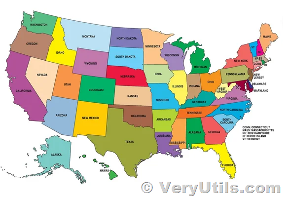
In today's digital landscape, interactive maps have become indispensable tools across various industries, from real estate and tourism to education and data visualization. VeryUtils MapSVG jQuery stands at the forefront of this revolution, offering a powerful solution to transform static SVG files into dynamic, fully customizable maps and floorplans.
https://veryutils.com/interactive-svg-map
What is VeryUtils MapSVG jQuery?
VeryUtils MapSVG jQuery is a versatile interactive map plugin designed to convert any SVG (Scalable Vector Graphics) file into an interactive map or floorplan with ease. Whether you are looking to create detailed geographic maps, intricate floorplans, or interactive vector images, MapSVG provides the tools necessary to bring your designs to life.
Key Features:
- Customizability Beyond Limits:
- Unlike traditional mapping solutions, MapSVG allows you to go beyond the limitations of pre-built maps. Design and customize maps using popular design tools like Adobe Illustrator or InkScape. Adjust regions, add new ones, or completely redefine boundaries according to your specific needs.
- Extensive Map Library:
- With over 100 built-in geo-calibrated SVG maps readily available, MapSVG provides a broad foundation to start from. These maps cover diverse regions and can be easily adapted to suit different geographical contexts.
- Versatile Applications:
- Create floorplans for buildings or venues, village plans for urban development projects, or interactive vector images for engaging visual content. MapSVG's flexibility ensures it can be tailored to various use cases, enhancing both functionality and visual appeal.
- Choropleth Mapping:
- Utilize choropleth maps to visually represent statistical data, making complex information easily understandable through color-coded regions that reflect data values.
- Advanced Control Panel:
- The intuitive control panel equipped with Live Preview allows real-time customization and previewing of changes, empowering users to fine-tune every detail of their interactive maps efficiently.
- Custom Event Handlers:
- Implement custom event handlers such as onClick, mouseOver, mouseOut, beforeLoad, and afterLoad to create interactive experiences that respond dynamically to user interactions, enhancing usability and interactivity.
Who Should Use VeryUtils MapSVG jQuery?
- Developers and Designers: Create interactive maps and floorplans for websites or applications with minimal effort, thanks to MapSVG's straightforward integration and customization options.
- Businesses: Enhance presentations, data visualization, and location-based services with interactive maps that engage and inform audiences effectively.
- Educators: Develop educational materials with interactive elements that make learning geography and spatial relationships more engaging.
Conclusion
VeryUtils MapSVG jQuery is not just a tool but a gateway to unlocking the potential of interactive mapping and visualization. Whether you are a developer, designer, educator, or business owner, MapSVG offers the flexibility, functionality, and ease of use to transform static visuals into dynamic, interactive experiences. Explore the endless possibilities of interactive maps with MapSVG and redefine how you present and interact with geographical data.
For more information and to explore the capabilities of VeryUtils MapSVG jQuery, visit https://veryutils.com/interactive-svg-map web page.
With VeryUtils MapSVG jQuery, the world map is truly at your fingertips.
