Scripts

VeryUtils Custom Interactive Map HTML5 Plugin

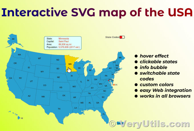
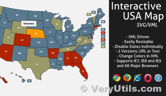
Crafting a personalized, interactive map with a professional touch has never been easier. The VeryUtils Custom Interactive Map HTML5 Plugin is the ultimate solution for effortlessly creating fully interactive maps from basic image or vector files. This plugin empowers users to design maps that are not only visually appealing but also highly functional and customizable to suit a variety of needs.

https://veryutils.com/interactive-svg-map

VeryUtils Custom Interactive Map HTML5 Plugin

✅ Main Features

Map Customization

  • Add Any Custom Map: Use SVG, JPG, PNG files, or choose from a built-in country map.
  • Zoom and Pan: Enable zoom and pan functionality or fullscreen mode for better visibility.
  • Clickable Locations: Add interactive, clickable locations to your map.
  • Multi-floor Support: Incorporate multiple files to enable support for maps with several floors or levels.
  • Filterable Directory: Enable and customize a directory that users can filter through.
  • CSV Integration: Easily import and export data from spreadsheets to manage your map data efficiently.
  • User-friendly Admin Interface: Manage your map with an intuitive and responsive admin interface.

The VeryUtils Custom Interactive Map HTML5 Plugin is an all-in-one custom mapping solution that is compatible with desktop computers, mobile devices, and even touch kiosks, making it a versatile tool for various applications.

✅ Use Cases

The VeryUtils Custom Interactive Map HTML5 Plugin is ideal for projects with a moderate number of points of interest and those that require unique and creative designs. While tile-based map services are better for highly detailed maps that need street-level zoom, this plugin excels in projects that prioritize customizability and aesthetic appeal.

  • Buildings/Complexes: Perfect for malls, resorts, hospitals, schools, and airports.
  • Real Estate: Ideal for showcasing lots, apartments, and other properties.
  • Events: Excellent for expos, festivals, and fairs, providing an interactive experience for attendees.
  • Geographic Regions: Suitable for creating detailed maps of the world, countries, regions, or cities.

✅ Built-in Maps

The VeryUtils Custom Interactive Map HTML5 Plugin includes a comprehensive set of built-in maps that you can configure within minutes. These maps cover various regions and countries around the world, including:

  • World Regions: World, Continents, World and US
  • Countries: Africa, Asia, Europe, Argentina, Australia, Austria, Belgium, Brazil, Bulgaria, Canada, China, Croatia, Cyprus, Czech Republic, Denmark, Estonia, Egypt, Finland, France, Germany, Greece, Hungary, Indonesia, India, Ireland, Island, Israel, Italy, Japan, Korea, Latvia, Lithuania, Malaysia, Mexico, Netherlands, New Zealand, Norway, Poland, Portugal, Romania, Russia, Saudi Arabia, Serbia, Slovakia, Slovenia, Spain, South Africa, Sweden, Switzerland, Thailand, Turkey, Ukraine, United Kingdom, United States, United Arab Emirates

In summary, the VeryUtils Custom Interactive Map HTML5 Plugin is a robust and versatile tool that brings high-quality, interactive maps to your projects. With its extensive features, user-friendly customization options, and built-in maps, it stands out as an essential component for any project requiring detailed and dynamic maps. Whether you're managing a complex, real estate properties, or planning an event, this plugin provides the flexibility and functionality you need to create visually stunning and interactive maps.
Scripts

VeryUtils Interactive and Clickable HTML5 SVG Map of Italy

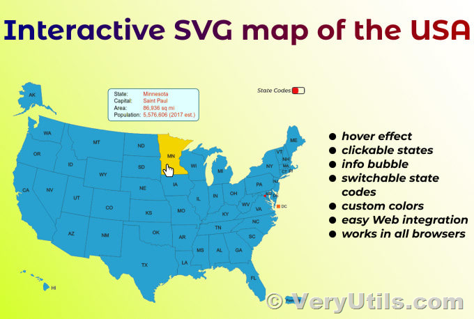
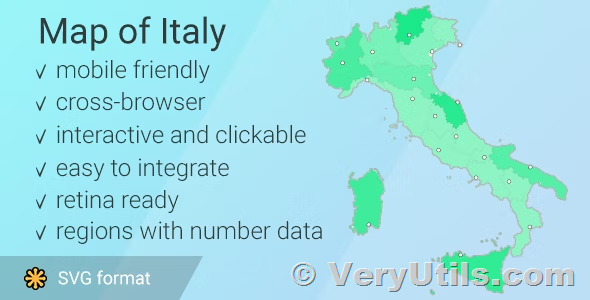
The VeryUtils Interactive HTML5 SVG Map of Italy is a powerful and professional tool designed to create interactive and visually appealing maps of Italy for your website. With features like clickable regions and cities, customizable pins, and responsive design, this map offers a versatile solution for businesses, educators, and anyone needing a detailed and interactive map of Italy.

https://veryutils.com/interactive-svg-map

VeryUtils Interactive and Clickable HTML5 SVG Map of Italy

Key Features

Interactive Map of Italy - Clickable Regions / Cities
The interactive template of the map of Italy provides an easy way to install and customize a professional-looking interactive map. It includes 20 clickable regions, each of which can be linked to any webpage. Additionally, you can add an unlimited number of clickable pins anywhere on the map, offering even more customization and interaction options.

Main Features

  • One-time Purchase
    No annual or subscription fees are required. A one-time purchase grants you full access to the map and its features.
  • SVG-Based, Responsive, and Fully Resizable
    The map is based on SVG (Scalable Vector Graphics), ensuring high-quality visuals that are responsive and fully resizable. It works perfectly on both desktop and mobile devices, including smartphones.
  • Customizable Regions
    Each region on the map can be customized independently. You can modify colors, links, hover information, and activation status to match your specific needs.
  • Customizable Pins
    Pins can be added anywhere on the map and customized independently. You can choose the shape (circle or square), size, position, colors, links, and hover information for each pin.
  • Linking and Modal Windows
    You can link each region or pin to any webpage or open a modal window. Note that the modal window option works only with the Bootstrap framework, so ensure compatibility with your website template or WordPress theme.
  • Easy Customization
    The map is easily customized through simple JavaScript files, with no JavaScript knowledge required. This makes it accessible for users of all technical skill levels.
  • Comprehensive Package
    The map package consists of HTML, CSS, and JS files. It also includes an installable WordPress plugin zip file, allowing for manual editing of simple JS files for customization.
  • Multiple Map Instances
    You can embed as many maps as you want on the same website across different pages. For WordPress, you can install up to three instances of the map plugin and use the shortcode as many times as needed on different pages.
  • SEO Friendly
    The map has a small file size, ensuring fast loading speeds and SEO friendliness.
  • Full Documentation
    The package includes full documentation with an interactive X, Y coordinates guide to help you place pins accurately.

List of Clickable Regions in the Map of Italy
Each region can be customized independently in terms of colors, links, hover information, and more. The regions include:

  1. Abruzzo
  2. Valle d'Aosta
  3. Puglia
  4. Basilicata
  5. Calabria
  6. Campania
  7. Emilia-Romagna
  8. Friuli-Venezia Giulia
  9. Lazio
  10. Liguria
  11. Lombardia
  12. Marche
  13. Molise
  14. Piemonte
  15. Sardegna
  16. Sicilia
  17. Trentino-Alto Adige
  18. Toscana
  19. Umbria
  20. Veneto

In summary, the VeryUtils Interactive HTML5 SVG Map of Italy is a robust and flexible tool that brings high-quality, interactive maps to your website. With its responsive design, customizable features, and user-friendly customization options, it stands out as an essential component for any project requiring a detailed and dynamic map of Italy. Take advantage of this tool for a one-time purchase and enjoy free lifetime updates and expert tech support.

Scripts

VeryUtils Interactive and Clickable United States SVG Map HTML5 Component

The VeryUtils United States SVG Map component is a cutting-edge tool designed to bring interactive and visually captivating maps of the United States to life within VeryUtils applications. Built using TypeScript, this component ensures seamless integration with both TypeScript and plain JavaScript projects, making it a versatile choice for developers. Leveraging SVG (Scalable Vector Graphics) technology, the VeryUtils United States SVG Map component delivers high-quality, scalable maps that maintain their clarity and detail across various screen sizes.

https://veryutils.com/interactive-svg-map

VeryUtils Interactive and Clickable United States SVG Map HTML5 Component

Key Features

Responsive Design
The VeryUtils United States SVG Map component is meticulously crafted to adapt to any parent container, providing a consistent user experience across different devices and screen sizes. Whether viewed on a desktop, tablet, or smartphone, the map remains clear and functional.

Customizable Colors
One of the standout features of this component is its flexibility in color customization. Users can easily modify all colors used in the map, allowing for effortless adaptation to match the aesthetic of any application. This ensures that the map can seamlessly integrate into the overall design of your project.

Interactive Features
Interactivity is at the core of the VeryUtils United States SVG Map component. It includes built-in callbacks that enable the handling of mouse events on specific regions of the map. This powerful feature allows developers to create dynamic user experiences, such as displaying information or triggering actions based on user interactions with the map.

Custom Tooltip Content
To enhance user engagement, the component offers the ability to customize tooltip content. Developers can display additional information when users hover over specific regions of the map, providing context-sensitive details that enrich the user's experience.

Custom SVG Markers
The component supports the addition of custom SVG markers, including images. This feature allows for the visualization of data or points of interest on the map, further enhancing the map's utility and visual appeal.

Marker Coordinate Tool
To streamline the development workflow, the VeryUtils United States SVG Map component includes a Marker Coordinate Tool. This tool simplifies the process of determining marker coordinates on the map, saving developers time and effort.

IntelliSense Support
Developers using TypeScript will particularly appreciate the IntelliSense support. This feature provides intelligent code completion when passing props, boosting productivity and reducing development time by making the coding process more efficient and error-free.

Compatibility
The VeryUtils United States SVG Map component is rigorously tested with VeryUtils 18 and Next.js 14, ensuring reliable performance and compatibility with these popular frameworks.

Documentation and Examples
Your download includes preview files in a Next.js project, complete with examples and full documentation. This comprehensive resource ensures that developers have everything they need to quickly and effectively implement the component in their projects.


In summary, the VeryUtils United States SVG Map component is a robust and versatile tool that brings high-quality, interactive maps to VeryUtils applications. With its responsive design, customizable features, and developer-friendly tools, it stands out as an essential component for any project requiring detailed and dynamic maps of the United States.

Scripts

How to Make a Clickable SVG Map With HTML and CSS?

What Is an SVG Map?

SVG, or Scalable Vector Graphics, is a versatile image format that you can use in a wide range of applications, from web design to print media and data visualization. SVG maps are vector-based, meaning that the map elements are defined by mathematical equations rather than pixels. This allows you to scale them up or down without losing quality.

VeryUtils Interactive SVG Map

https://veryutils.com/interactive-svg-map

How to Make a Clickable SVG Map With HTML and CSS?

What Are the Benefits of an SVG Map?

SVG maps offer numerous benefits, making them a popular choice among designers and developers:

  • Scalability: SVG maps can be scaled up or down without losing quality, making them ideal for use in responsive web design or for printing at different sizes.
  • Customizability: SVG maps can be easily customized to suit specific needs, such as changing colors, adding labels, or modifying the size and shape of map elements.
  • Interactivity: SVG maps can be made interactive through the use of JavaScript and CSS, allowing viewers to hover over or click on specific elements to see more detailed information.
  • Accessibility: SVG maps can be read by assistive technologies such as screen readers, making them more accessible to people with disabilities.
  • Cross-platform compatibility: SVG maps can be displayed on a wide range of devices and browsers, making them a versatile choice for web-based applications.

Example of SVG Maps in the Wild

Stears and The BBC have used SVG maps to visualize election data. Users can click on a region to see the distribution of ballots cast, providing a clear and interactive way to understand election results.

How to Set Up the HTML File?

How to Create the Basic HTML Structure?

To start, you need to create the basic HTML structure for your webpage:

        
            <!DOCTYPE html>
            <html lang="en">
            <head>
                <meta charset="UTF-8">
                <meta name="viewport" content="width=device-width, initial-scale=1.0">
                <title>Clickable SVG Map</title>
                <link rel="stylesheet" href="styles.css">
            </head>
            <body>
                <div id="map-container">
                    <!-- SVG map will be inserted here -->
                </div>
                <script src="script.js"></script>
            </body>
            </html>


How to Import the SVG Map File?

Next, import your SVG map file into the HTML structure. You can either embed the SVG directly into the HTML or link to an external SVG file. Here’s how you can embed it directly:

        
            <div id="map-container">
                <svg xmlns="http://www.w3.org/2000/svg" viewBox="0 0 1000 1000">
                    <!-- Your SVG map content here -->
                </svg>
            </div>


How to Set Up the div Container for the Map?

Ensure the <div> container is styled appropriately to hold your SVG map. This can be done through CSS:

        
            #map-container {
                width: 100%;
                height: auto;
                max-width: 800px;
                margin: 0 auto;
            }


How to Add Interactivity with CSS?

How to Style the SVG Map?

You can style the SVG map elements using CSS. For example:

        
            svg {
                width: 100%;
                height: auto;
            }

            path {
                fill: #cccccc;
                stroke: #ffffff;
                stroke-width: 2;
            }


How to Add Hover Effects?

Adding hover effects can make your map interactive and visually appealing:

        
            path:hover {
                fill: #ffcc00;
                cursor: pointer;
            }


How to Add Click Effects?

To indicate that an element is clickable, you can add a click effect:

        
            path:active {
                fill: #ff9900;
            }


How to Add Functionality?

How to Link Areas of the Map to External Webpages?

To make parts of your SVG map clickable and link to external webpages, you need to use the <a> element within your SVG:

        
            <a href="https://example.com/region1" target="_blank">
                <path d="M10 10 H 90 V 90 H 10 Z" />
            </a>


This way, clicking on a specific region will navigate the user to the desired webpage.

Conclusion

Recap of Steps to Make a Clickable SVG Map

  1. Set Up the HTML File: Create a basic HTML structure and import your SVG map file.
  2. Add Interactivity with CSS: Style the SVG map, and add hover and click effects.
  3. Add Functionality: Link areas of the map to external webpages for interactive navigation.

Final Thoughts and Suggestions for Further Customization

Creating a clickable SVG map with HTML and CSS is a straightforward process that can significantly enhance the interactivity and visual appeal of your web projects. With the scalability, customizability, and interactivity of SVG maps, you can create dynamic data visualizations that engage and inform your audience. For further customization, consider integrating JavaScript for more complex interactivity, such as displaying tooltips or fetching data dynamically based on user interactions.

Photo Software

Remove object from photo online in seconds with VeryUtils Free AI Object Remover

Effortless Object Removal with AI Technology

In the world of digital photography, achieving a clean and professional image often requires the removal of unwanted objects. This process, traditionally done using complex software like Photoshop, can be time-consuming and demands a certain level of skill. VeryUtils Free Image Object Remover changes the game by offering a powerful, user-friendly solution that automates this process with cutting-edge AI technology.

https://veryutils.com/photo-object-remover

Remove object from photo online in seconds with VeryUtils Free AI Object Remover

Remove Objects in Seconds

Say goodbye to hours of meticulous editing. With VeryUtils, you can remove objects from photos in mere seconds. Simply brush over the undesired elements, and the AI will handle the rest, erasing them seamlessly. This tool is designed for users of all skill levels, ensuring anyone can achieve professional-quality results without any prior photo editing experience.

High-Quality AI Object Removal

Powered by advanced artificial intelligence, VeryUtils Free Image Object Remover analyzes the textures and patterns around the selected area and fills it in using sophisticated image inpainting techniques. The result is a flawless image that retains its original clarity and quality. Whether you’re removing a small blemish or a large object, the tool delivers precise and high-quality results every time.

Replace Unwanted Objects

What sets VeryUtils apart is its ability to not only remove objects but also replace them with something new. After marking the object for removal, you can input a short text prompt describing what you’d like to appear in its place. The AI will generate a realistic replacement, blending it perfectly with the surrounding image. This feature opens up new creative possibilities for your photos.

Versatile Photo Editing Capabilities

VeryUtils Free Image Object Remover is more than just an object removal tool. It offers a suite of features tailored to various editing needs:

  • Remove People: Effortlessly eliminate unwanted photobombers or crowds from your shots.
  • Remove Skin Imperfections: Get rid of blemishes, pimples, wrinkles, and scars with ease. Enhance portraits with additional tools like red-eye correction, teeth whitening, and digital makeup.
  • Remove Text and Watermarks: Erase watermarks, date stamps, captions, logos, and stickers without affecting the background.
  • Retouch Product Images: Create clean, distraction-free product photos with white backgrounds, perfect for online stores and social media.
  • Repair Old Photos: Restore old photographs by removing scratches, tears, spots, and stains. You can also colorize black-and-white images with a single click.
  • Clean Up Real Estate Imagery: Remove unwanted objects, furniture, and clutter to present properties in their best light.
  • Remove Confidential Details: Erase sensitive information like street signs and license plates to protect privacy.

Simple Steps to Remove Objects from Photos

Removing objects from photos with VeryUtils is straightforward:

  1. Upload Your Photo: Start by uploading the image you want to edit.
  2. Brush Over the Object: Use the brush tool to paint over the object you wish to remove. The AI will automatically analyze and erase it.
  3. Download Your Image: Once you’re satisfied with the edits, click the “Download” button to save your new image in high resolution.

Experience the Future of Photo Editing

VeryUtils Free Image Object Remover offers an intuitive, efficient, and powerful way to enhance your photos. Whether you’re cleaning up personal snapshots or preparing professional images, this tool provides all the features you need to achieve stunning results with minimal effort. Try VeryUtils today and take your photo editing to the next level!